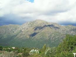
Uritorco (uritu urqu = "parrot hill" in Quechua) is a 1,979 m (6,500 ft) peak in central Argentina, located in the northern Punilla Valley, in Capilla del Monte, in the province of Córdoba, accessible by National Route 38 and Provincial Route 17. Its summit is the highest elevation in the Sierras Chicas, formerly known as Viarava. It is considered the sixth Natural Wonder of Córdoba.
The hill was formed by faulted and ascended Paleozoic blocks. Nearby (on the northern slope) is "Los Terrones," an Indigenous, Cultural, and Recreational Park, a site of historical, cultural, and scenic significance. Perhaps it was a geological fault that truly draws attention due to its distinct terrestrial composition, its color, and the variation in its various straits and passages caused by wind and sea erosion, creating an "enchanted landscape." Others call it "a place of wonder." Culturally, these lands were also inhabited by members of ethnic groups such as the Comechingones, who lived throughout the province of Córdoba. For example, on Pajarillo Hill, at 1,690 meters, the second highest in the Sierras Chicas, and in the Ongamira Valley or the Ongamira Caves, which until the 16th century were a settlement of the Comechingones culture.
Numerous watercourses descend from Uritorco Hill, many of them underground, forming hot springs. Among these, the small Calabalumba River—almost dry during the summer—stands out, flowing west past Capilla del Monte.
From a scenic point of view, Uritorco offers significant attractions. First, it stands out as a massive, steeply sloping mass among the other mountains. During clear evenings, precisely at the time of sunset, much of the slopes take on a brilliant golden hue. From its summit, one has a magnificent view of the surrounding valleys. The viewpoint is located above the most frequent cloud cover; however, these clouds do not usually obscure the view of the lowlands, as gusts of fresh wind constantly create clear areas between the clouds or their haze. Condors and vultures are frequently seen gliding around the summit.
During the winter, the Uritorco is covered in ice and snow. During the fall (from April to June), however, the landscape turns yellow and coppery due to the red quebracho trees and the foliage of the deciduous trees.
Uritorco Hill is privatized, so you have to pay to climb it, although it is well signposted and protected.
The slopes of Uritorco are populated by caranday palms (called "cocos" in Córdoba, even though they do not produce coconuts), followed by a layer of deciduous trees typical of cold climates, including the molles. Around 1,500 m above sea level, there are high-altitude meadows, mosses, lichens, some ferns, and rocky areas almost devoid of vegetation. For all these reasons, this mountain is a Nature Reserve, although it is in private hands.
Regarding the ascent of this mountain, the most popular trail is located southwest of its base and slopes. This trail is relatively easy to climb during daylight hours and therefore requires little equipment, except for sturdy, well-supported footwear, a readily improvised walking stick, and a canteen or water bottle. It is essential that those attempting the climb be in good physical condition. The other trails are much more difficult, reaching a difficulty level of "5"; there are precipices in certain parts of the northern slopes.


